The phase of inversion can only be executed after completing the spectral analysis. The window shows the points on which the inversion will be carried out and the velocity-frequency spectrum graph. As a first step is necessary to set the ground model on which the processing will be based. If you have defined a preliminary model in the process of spectral analysis, it is automatically copied.
The parameters to define are:
•number of layers;
•minimum thickness of research;
•initial thickness of research;
•maximum thickness of research;
•weight per unit of volume;
•saturated weight per unit of volume;
•presence of water;
•Poisson's ratio;
•minimum speed of the wave permissible for layer;
•wave velocity for the first attempt;
•maximum speed of the wave permissible for layer;
The result of inversion is strongly dependent on the settings chosen for the model so that the user should modify as needed the setup parameters.
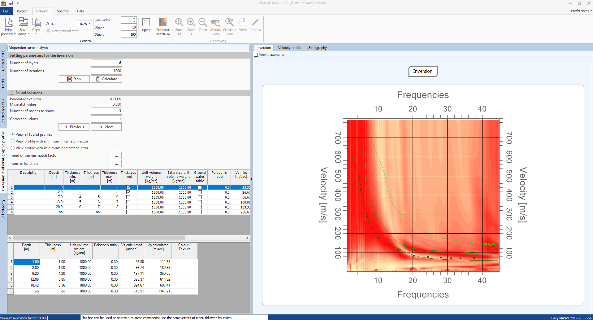
To determine the soil stratigraphy model that generates a dispersion curve similar to that obtained from the experimental research, the software applies a heuristic algorithm. From the model set by the user, the solver builds a set of compatible models and for each of them compares the dispersion curve generated with that of the experimental test. The generation of models is formulated to minimize the value of an objective function that evaluates the efficiency of the solution given by the model. The maximum number of patterns to generate is selectable by the user and should be chosen so that there are processed a sufficient number of attempts. It is possible to directly assess the performance of the value of the objective function; this parameter may prove to be a good indicator for choosing the number of models to generate.
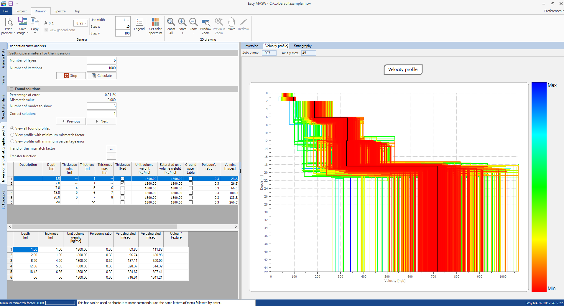
The software displays the model that has the lowest mismatch factor, the model with the minimum value of percentage error and provides the parallel evaluation of all the models examined by allowing the user to choose which to use among those analised.
It is also possible to impose computation constraints to the solver. In fact, you can choose, for each layer, a fixed rate or a thickness that will not be optimized in the computation and use models of the stratigraphy which does not allow the velocity inversion between the layers.
The graphic output can also highlight the higher modes, identified as a solution for the model chosen, while the computation results are summarized in the lower grid.
Other operations that can be made at this phase are:
•export the displayed images;
•fit the size of texts;
•operate on the charts with tools such as zoom, pan etc..
© 2020 Geostru