It is possible to work on the topographic surface by importing it through a text file, CSV or GMT, or by manually inserting the points.
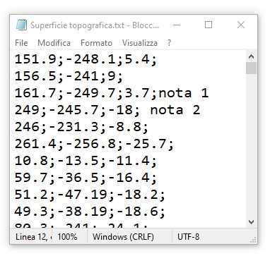
The .txt text file containing the points of the topography must have the following formatting:
In the case of XYZ coordinates the file must have 4 columns separated by a semicolon as shown below, so:
X coordinate;Y coordinate;Z coordinate;note
The .csv files must consist of 4 columns composed as above.
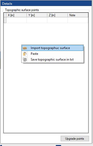
To import the topographic surface it is possible to select the file to import and by dragging it to the “Topography” button or by clicking with the right button of your mouse on the point table and therefore on the “Import topographic surface”.
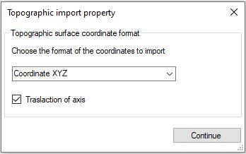
After uploading the file, you will be asked to specify the format of the coordinates.
For a fluidity purpose it is advised to leave the “Translation of the axis” box checked, this setting allows the imported surface to get nearer to the original location of the system.
By clicking on “Continue” the chosen surface will be drawn.
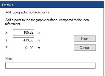
The manual insertion of the points can be done by clicking with the right button of your mouse on “Add point”, and consequently inserting the XYZ coordinates of the point.
Every point inserted can be deleted or modified, by clicking with the right button of your mouse on the point, therefore on remove or modify.
The same operation can be done through the table that can be viewed by clicking on “Topography”, and after on “Upgrade points”.
After clicking on “Topography”, it is possible to do a check on the points of the surface by clicking on “Check topography”, with this option the topographic surface, if necessary, will correct itself in order to optimize the 3D model.
© GeoStru