General data menu allows the user to enter specific details of the current project:
•Description;
•Project Engineer;
•Customer;
•Date.
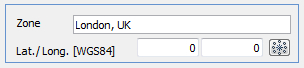
Zone
By entering the location in this format: street xxxx, city, state, country, the work area it will be automatically identified. Alternatively, assign coordinates in WGS84 system in decimal degrees.
The system requires an internet connection for the identification of the area.
Soil type
Choose from loose soil or rock according to the type of soil on which rests the foundation.For foundations on rock, the program automatically adjusts the data window of the stratigraphy (ex. RQD).
Correction parameters
For predominantly sandy soils, Terzaghi suggested to apply a correction on the geotechnical parameters, which is to reduce the cohesion to 2/3 and the tangent of the shearing resistance angle to 0,67·tan(j).
We recommend applying this correction only to DA1/1 and il DA2 (EC7). |
To estimate the seismic effects on the site is better, at this point, to select the seismic normative and the computation methods to be used.
© GeoStru