To insert a new survey just press the "Add survey" button in the "Project-Survey" menu (or use the context menu viewed at a right click in the left panel containing the "New area" text in the main window) and specify the name for it.
For each survey are available a series fields for general information, as well a list of parameters to be analyzed.
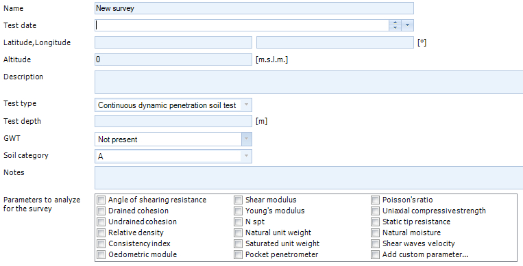
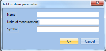
The user has the possibility to insert custom parameters (check "Add custom parameter").
The "View on map" option gives the possibility to view the area on Google Maps.
By selecting the image using the "Capture view" button the user can send the current position to the computation report to be printed. Various objects (such as lines, circles, rectangles, text) can be inserted in the image, and also modified the color and thickness of the lines, the background color and percentage of transparency.
|
©GeoStru