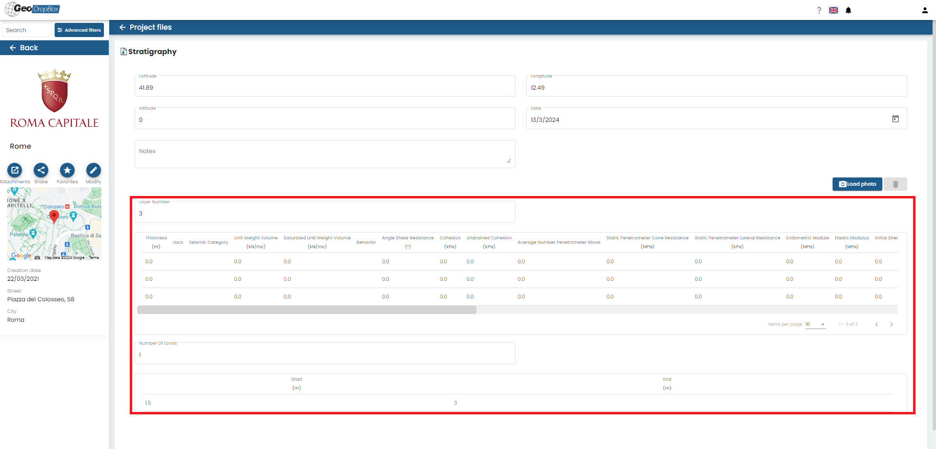
With 'Stratigraphy' it is possible to create stratigraphic columns for geological and geotechnical use.
It is necessary to define the number of layers a priori and then it is possible to enter multiple data such as:
•Thickness (m);
•USCS classification;
•Seismic category;
•Unit Volume Weight (kN/mc);
•Saturated Volume Unit Weight (kN/mc);
•Behaviour;
•Shear Resistance Angle (°);
•Cohesion (kPa)
•Undrained Cohesion (kPA);
•Number of Medium Penetrometer Strikes;
•Static Penetrometric Point Resistance;
•Static Penetrometric Lateral Resistance;
•Edometric Modulus (Mpa);
•Elastic Modulus (Mpa);
•Initial Shear Deformation Modulus (Mpa);
•Dynamic Shear Deformation Modulus (Mpa);
•Poisson Coefficient;
•Winkler Coefficient (N/cm3);
•Degrees of Overconsolidation;
•Relative Density (%);
•Percentage Fine (%);
•Permeability Coefficient (m/s);
•Compression Wave Velocity (m/s);
•Shear Wave Velocity (m/s);
•Primary Consolidation Coefficient (m2/s);
•Secondary Consolidation Coefficient (m2/s);
•Voids Index (%);
•Plasiticity Index (%);
•Cbr;
•Rock Quality Designation (%);
•Description;
•Layer colour.
In addition to the terrain, it is possible to map the presence of one or more ground-water zones by entering:
Number of ground-water zones;
Start (m) and End (m) of each zone.
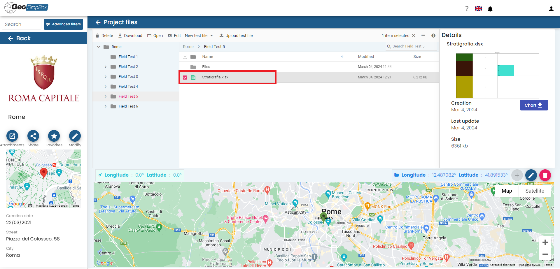
Once the data have been entered and the "Save Changes" button is pressed, the service will generate the downloadable stratigraphy as an image and the file Stratigraphy.xlsx with all the entered data, downloadable by the user.
© GeoStru